Remembering Beaconsfield Farms
Jill Adams

Beaconsfield is still largely surrounded by farmland because of the policy of the Green Belt in the Town and Country Planning Act 1947. The development of the area is not the usual one of a nucleated village, surrounded by arable land. The pattern here was rather that of a large number of farms, scattered over the parish.
The large estates had their ‘Home Farms’. That of Butler’s Court was near where the Adult Learning Centre now stands; Hall Barn’s is now used as offices for the estate; Wilton Farmhouse still exists. However, records show that there were originally over thirty farms and smallholdings in the Beaconsfield area. Many of these have completely disappeared but some live on, preserved as house names, road names or districts.
Farm names continue to be used
The last mention of Ledborough as a farm is on the Tithe Map of 1846. Today the name continues with Ledborough Lane, Ledborough Wood and Ledborough Gate. The latter is a development of expensive houses, as far removed from anything to do with a farm as is possible to get. Wattleton Road remembers Wattleton Farm which was demolished in 1891 in order to build the entrance to Butlers Court. Rolfe Close, just off Wattleton Road, is named after William Rolfe who died in 1866, leaving a widow and three sons. The Rolfe family lived at both Wattleton and Widgenton Farms. Knotty Green Farm was a delightful small Georgian farmhouse which was demolished and replaced by a modern house. Knotty Green district is one of the more characterful areas of Beaconsfield where some older houses do still remain.
A new lease of life
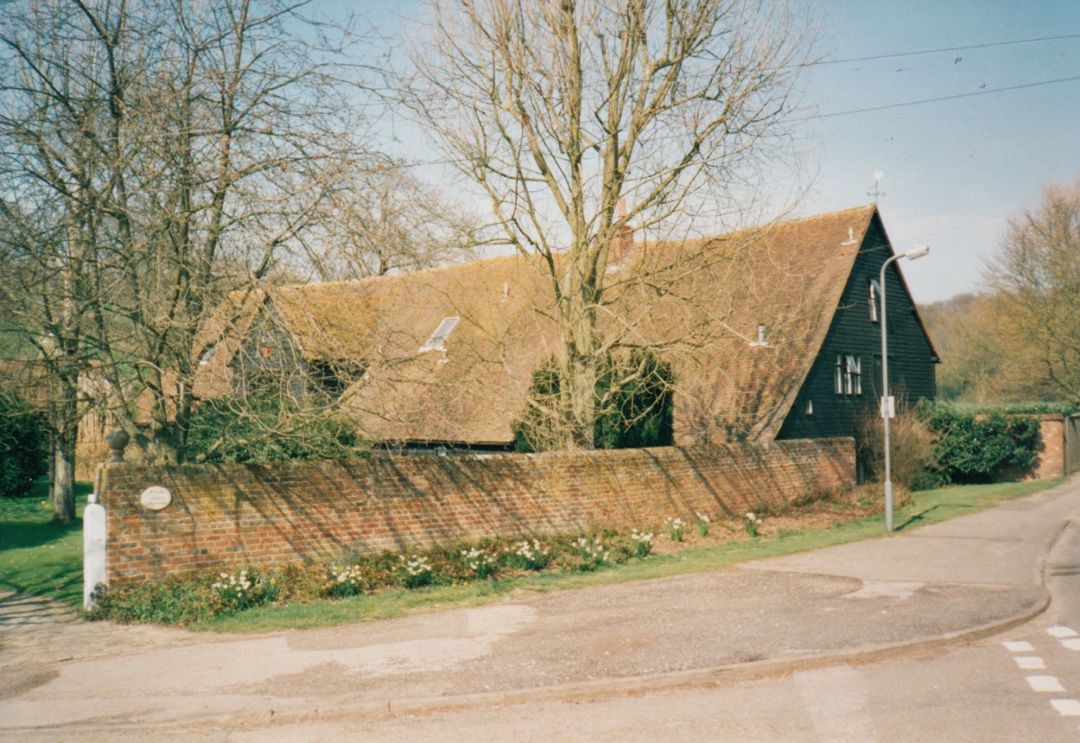
Other farmsteads still exist but with considerable changes. Davenies, no longer a farm, was one of the first to benefit from a new lease of life. The small square Georgian house has been incorporated into what is now a successful private school. In 1940, Mr and Mrs Petty who owned a school in Northwood, Middlesex, decided to move to a safer area following the outbreak of the Second World War. Accompanied by the headmaster and six pupils, they moved into Davenies Farm which became Davenies School.
The land surrounding Beaconsfield was particularly suitable for growing cherries. There were large orchards, one of which was at Seeleys Farm; the 400 year old farmhouse and barns are now in the middle of a housing estate. The family name of one of the farm owners is recorded in Wooster Road, just off Seeley’s Road.
In Holtspur there were three farms. The largest of these, Holtspur Farm, had two rooms which made up The Kings Head Inn. In 1905, The King’s Head Inn continued as a local hostelry until the land on either side was developed or added to other farms. The farmhouse then became The King’s Head public house (now The Harvester). Ivins Road perpetuates the name of a previous owner of Holtspur farm and inn. Holtspur Top Farm included land on the south side of the A40 where Holtspur Cemetery now is. The farmhouse became derelict and was demolished – the cul-de-sac Top Farm Close is a reminder of the farm’s existence. The farmhouse, stables and large barn of Holtspur Bottom Farm have been restored and modernised and continue their existence but as an attractive home. The land that once belonged to this farm has been incorporated with the adjoining farm at Forty Green.
Lude Farm, north west of the town is still a working farm and is referenced in the Doomsday Book.


Comments about this page
I was born at 5 Hedgerley Lane in April 1939. One of the most enjoyable time was to help pick cherries at
Hyde Farm, Pyebush Lane. There was several cherry and plum orchards there, and Mr Aldridge who had
greengrocers businesses around High Wycombe bought all that was picked. Hyde Farm was on crossroads Hedgerley Lane and Pyebush Lane which
was cutoff when M40 came through in 1960s.
I think the orchards were removed and possibly houses built.
F Webster – Unfortunately Farm End (10 Burkes Rd) was demolished and a ‘McMansion’ erected! I found this planning application from 2001 which was refused but it must have been granted later. (https://pa.chilternandsouthbucks.gov.uk/online-applications/applicationDetails.do?activeTab=documents&keyVal=0100134FUL). Looks like a Mr Lister lived there in 1993, and something to do with medicine, so i wonder if its the same Lister who owned the chemist just a few hundred metres away: https://pmj.bmj.com/content/postgradmedj/69/814/634.full.pdf It would have been called Farm End as it backed onto Gregories farm, the buildings of which are all still there.
Does anyone know the location of ‘Farm End’, Burkes Road and whether or not it still stands? In the 1930s it was the residence of Major-General Sir Percy Cyriac Burrell Skinner (Ret’d) and my mother was in service to him.
Whilst researching my family tree I discovered that my 3xGreat Grandparents, Thomas and Elizabeth Hearne and family, lived at Davenies farm at the time of the 1841 census. Does anyone know whether they, or any other Hearnes, were living there prior to then? Thomas died in 1863 and his son, Walter, then took over the farm. He had no children so I presume the farm went out of the family when he died in 1900. I know he was still there in 1891 from the census of that year. Pleased to know the name of the farm lives on.
Add a comment about this page